

Niagara County
NYGenWeb


1829
Courtesy of the NY Public Library
1884 Map of Niagara County
Source: "New York", George F. Cram, Engraver and Publisher, Chicago

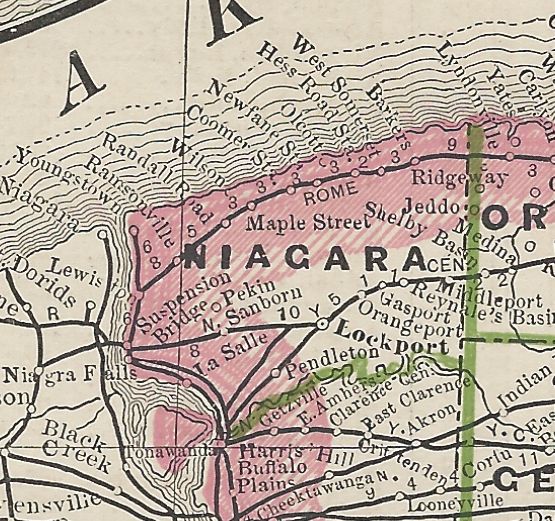
1895 Map of Niagara County
Source: "Atlas of the World" Rand McNally Corp.

1897 Map of Niagara County
Source: "The Century Atlas", The Century Co., NY, 1897

1836 Map of Niagara County
Source: "Gazetteer of the State of New York,"
by Thomas F. Gordon, T.E. and P.G. Collins, Printers, Philadelphia, 1836

1836 Map of Lockport
Source: "Gazetteer of the State of New York,"
by Thomas F. Gordon, T.E. and P.G. Collins, Printers, Philadelphia, 1836

1836 Map of Niagara Falls
Source: "Gazetteer of the State of New York,"
by Thomas F. Gordon, T.E. and P.G. Collins, Printers, Philadelphia, 1836

Cambria, Hartland, Lewiston, Lockport, Newfane, Niagara, Pendleton, Porter, Royalton, Somerset, Wheatfield, Wilson
Source: Information drawn from The Streets of Lockport: with Notes on the Early History of the City, by Mrs. Charles A. Kaiser (Niagara County Historical Society, second edition, Feb. 1949).
Copyright © 1996 - The USGenWeb® Project, NYGenWeb, Niagara County

This page was last updated
03/28/2025